Geologic
evolution
Pre-rift history: flood basalt volcanism
and plateau uplift
Tertiary rifting in Ethiopia was preceded by emplacement of
voluminous flood basalts that apparently occurred in a rather
short time interval at around 30 Ma; strong plateau uplift,
which resulted in the development of the Ethiopian and Somalian
plateaus now surrounding the rift valley, initiated contemporaneously
or shortly after the extensive flood basalt volcanism, although
its exact timing remains controversial. Occurrence of voluminous
volcanism and uplift prior to the main rifting phases has been
used as an argument to suggest a mantle plume influence on the
Tertiary deformation in East Africa. Recent plume models indicate
the existence of a deep superplume structure originating at
the core-mantle boundary beneath southern Africa, rising in
a north-northeastward direction toward eastern Africa, and feeding
multiple plume stems in the upper mantle. However, the characteristics (and even the existence) of mantle plume(s) beneath the African continent are debated.
Uplift of the Ethiopian/Somalian and East African plateaus has been suggested to
have had a first-order impact on the climate evolution of East Africa in the last 8 Myr. Indeed, by inducing a drastic reorganization of atmospheric circulation and by forming orographic barriers to moist air, this uplift led to a progressive aridification and caused a gradual replacement of closed forest woodlands by open savanna grassland. This in turn, may have controlled the evolutionary paths of East African hominins, particularly forcing an arid-adaptive evolutionary path for Homo sapiens.
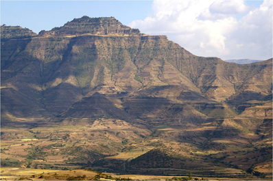
Traps close to Debre
Lybanos (click for a larger version)
Traps close to lalibela (click for a larger version)
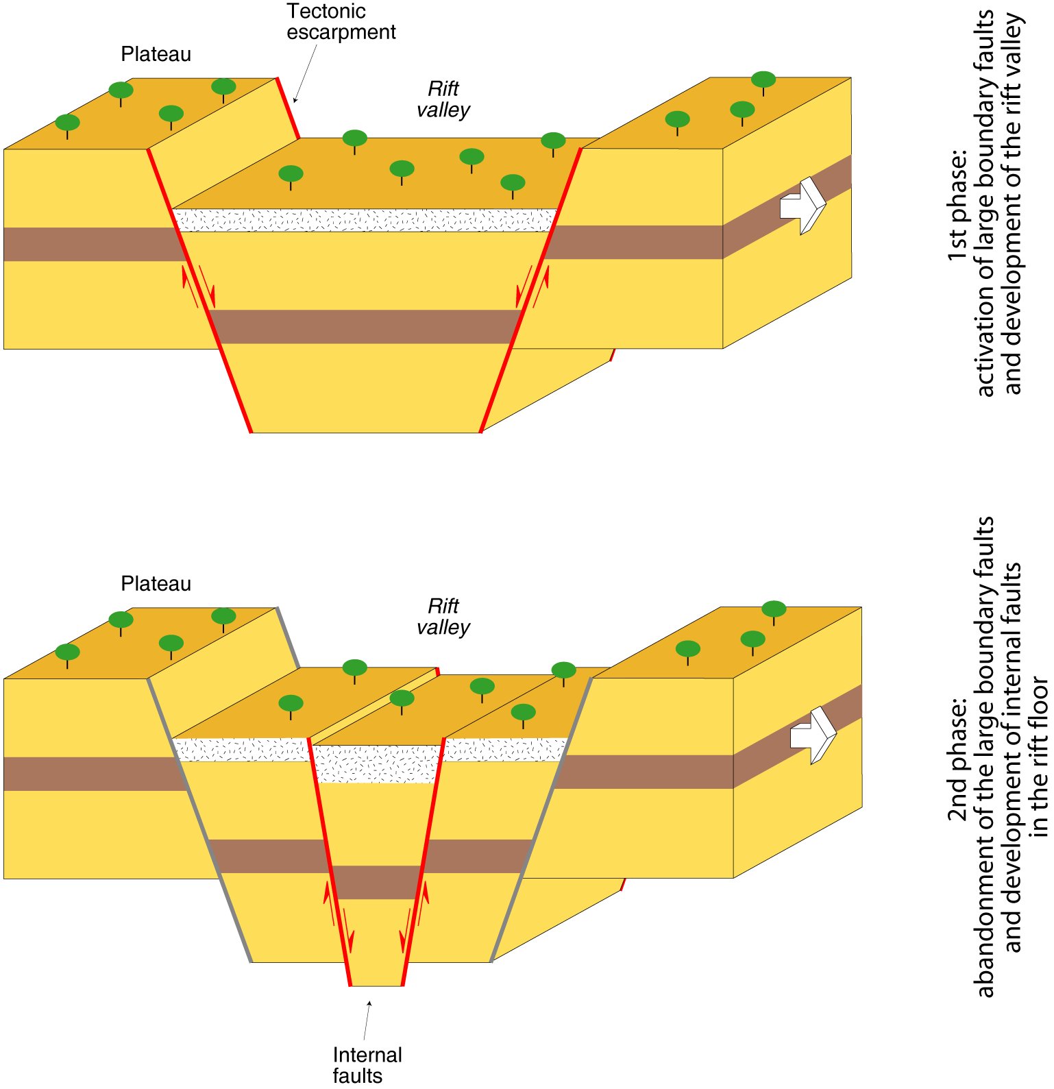
Rift evolution: rift localisation
and activation of large boundary faults
The main rifting phases started diachronously along the Ethiopian
Rift Valley in the Oligo-Miocene; rift propagation was not a
smooth process but rather a process with punctuated episodes
of extension and relative quiescence. The extensional deformation
is controlled by the relative motion of the three major plates
Arabia, Africa and Somalia; in the Afar depression, rifting
is controlled by the Africa-Arabia divergence, whereas to the
south extension is controlled by the Africa-Somalia motion.
Rift location was most probably controlled by the reactivation
of a lithospheric-scale pre-Cambrian weakness; south of the
Afar depression, the orientation of this weakness (roughly NE-SW)
and the Miocene (post-11 Ma)-recent extensional stress
field generated by relative motion between Nubia and Somalia
plates (roughly ESE-WNW) suggest that oblique rifting conditions (i.e., extension direction not orthogonal to the trend of the rift axis)
have controlled rift evolution. Analysis of geological-geophysical
data from the Main Ethiopian Rift suggests that continental rifting typically evolved in two different
phases. An early rifting stage was
characterised by displacement along large boundary faults, subsidence
of rift depression with local development of deep (up to 5km)
asymmetric basins and diffuse magmatic activity. In this initial
phase, magmatism encompassed the whole rift, with volcanic activity
affecting the rift depression, the major boundary faults and
limited portions of the rift shoulders (off-axis volcanism).
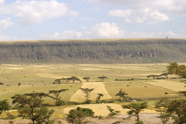
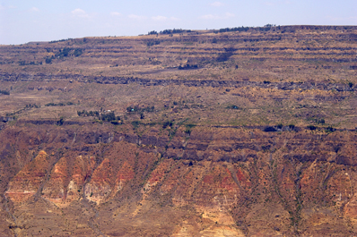
Large
normal fault close to Golja (click for a larger version)
Rift evolution: Abandonment of boundary
faults and development of internal fault segments
Progressive extension led to the second rifting
stage, well expressed in the Northern part of the rift, characterised
by a riftward narrowing of the volcano-tectonic activity. In
this phase, the main boundary faults were deactivated and extensional
deformation was accommodated by dense swarms of faults with
associated intense volcanism (tectono-magmatic segments) in
the axis of the thinned rift depression. The progressive thinning of the
continental lithosphere controlled this migration of deformation,
possibly in tandem with the weakening related to magmatic processes.
In the Main Ethiopian Rift, owing to the oblique rifting conditions,
the axial fault swarms obliquely cut the rift floor and were characterised
by a typical right-stepping arrangement. Ascending magmas were
focused by the tectono-magmatic segments, with eruption of magmas
at surface preferentially occurring along the oblique axial faults.
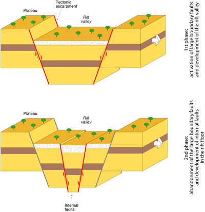
The two phases
of evolution of rifting (click for a larger version)
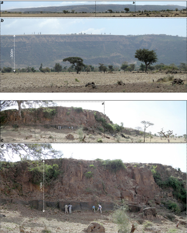
Morphological
difference between the large boundary faults (top) and the Wonji
faults (bottom) (click for a larger version)
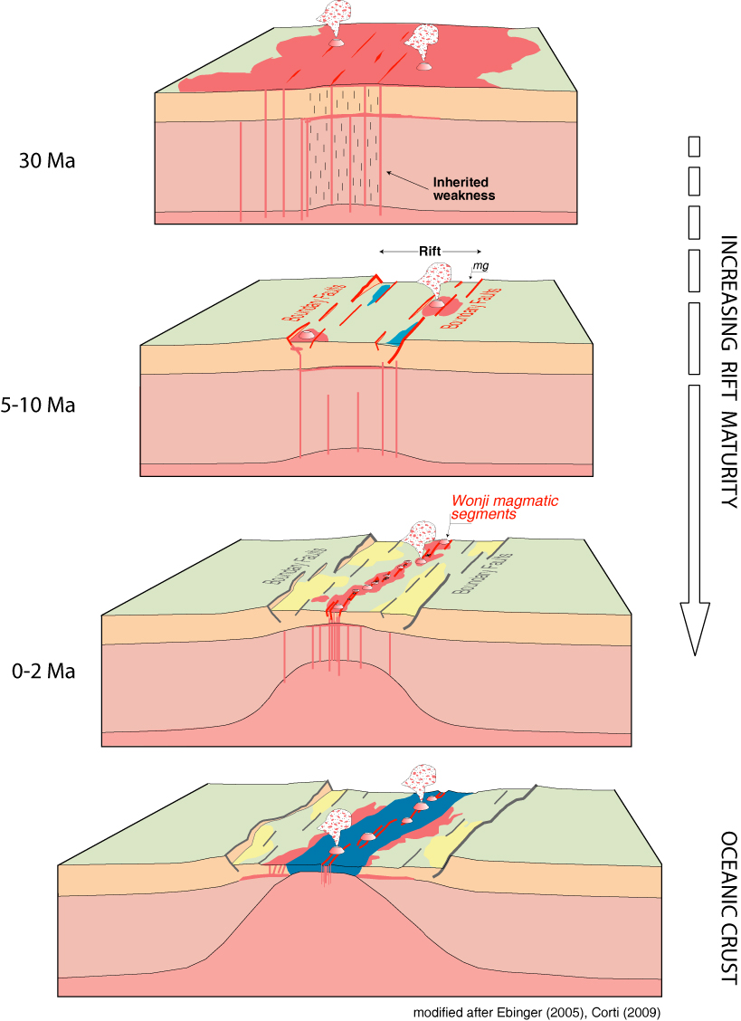
Continental break-up
As soon as the volcano-tectonic activity was localised within
the internal tectono-magmatic segments, a strong feedback between
deformation and magmatism developed: the thinned lithosphere
was strongly modified by the extensive magma intrusion and extension
was facilitated and accommodated by a combination of magmatic
intrusion, dyking and faulting. In these conditions, focused
melt intrusion allows the rupture of the thick continental lithosphere
and the magmatic segments act as incipient slow-spreading mid-ocean
spreading centres sandwiched by continental lithosphere. Overall
the above-described evolution documents a transition from fault-dominated
rift morphology in the early stages of extension toward magma
assisted-rifting during the final stages of continental break-up.
A strong increase in coupling between deformation and magmatism
with extension is documented, with magma intrusion and dyking
playing a larger role than faulting in strain accommodation
as rifting progresses to seafloor spreading.
Schematic model
of rift evolution in the Main Ethiopian Rift (modified after
Ebinger, 2005, Astronomy and Geophysics) (click
for a larger version)
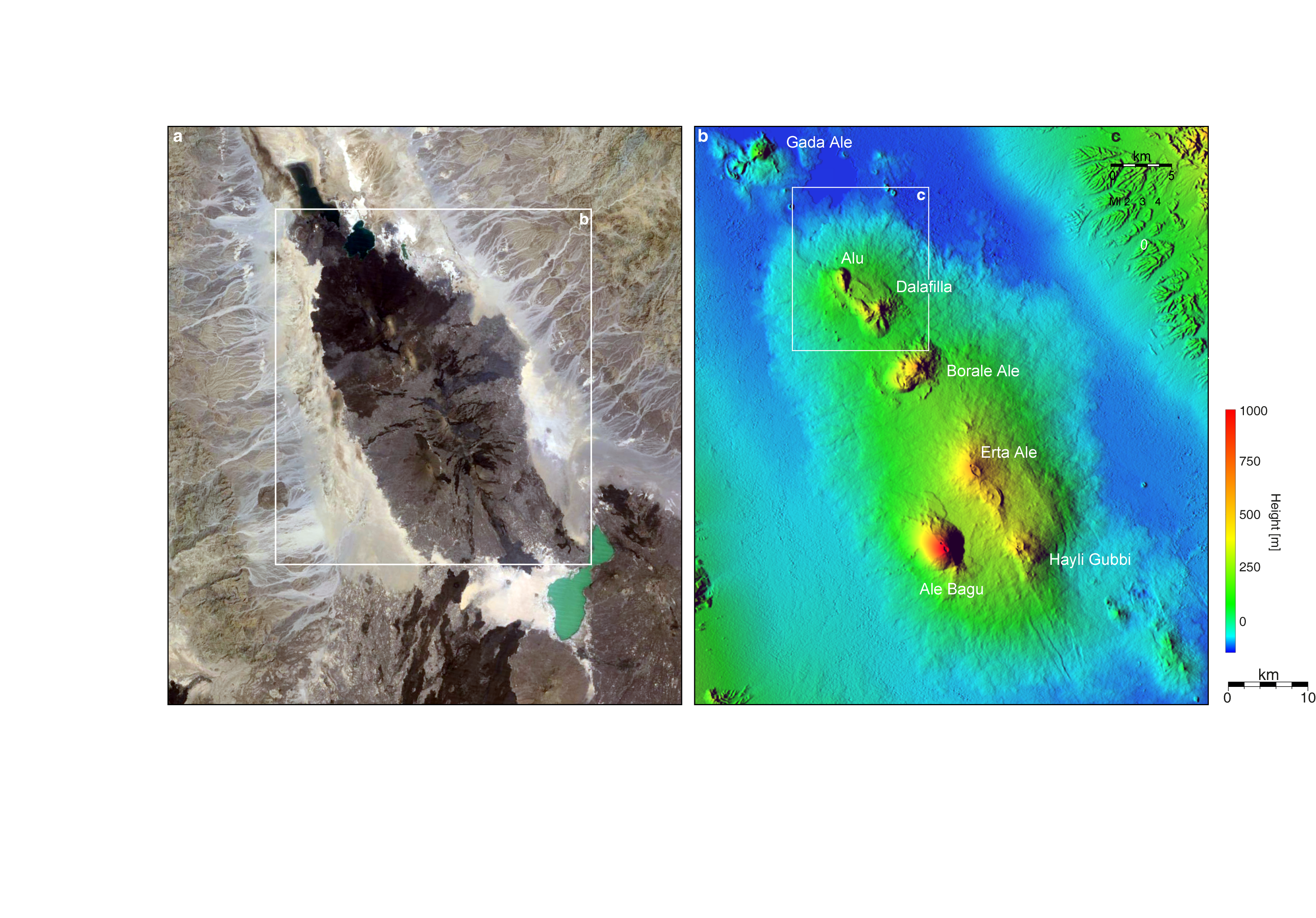
The final stages of break-up are exposed free of cover by seawater in the Afar depression, where Quaternary axial volcanic ranges like Erta Ale are believed to behave as subaerial mid-ocean ridges. Portions of the Afar depression have been shown to be characterised by subaerial magnetic stripes similar in pattern and amplitude to those that characterize seafloor spreading
centers.
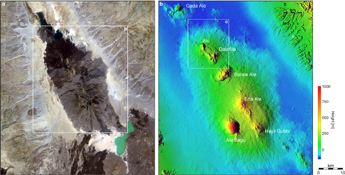
THe erta ale range in the danakil depression (northern afar) (click
for a larger version)